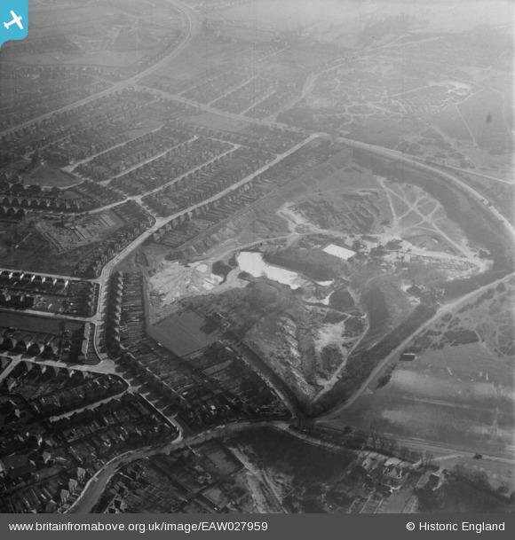
EAW027959 ENGLAND (1950). Crayford Sand and Gravel Pits Ltd Pit at Bowmans Estate, Bowmans, 1950
    © Copyright OpenStreetMap contributors and licensed by the OpenStreetMap Foundation. 2025. Cartography is licensed as CC BY-SA.
  
Nearby Images (6)
Details
| Title | [EAW027959] Crayford Sand and Gravel Pits Ltd Pit at Bowmans Estate, Bowmans, 1950 | 
| Reference | EAW027959 | 
| Date | 14-March-1950 | 
| Link | |
| Place name | BOWMANS | 
| Parish | |
| District | |
| Country | ENGLAND | 
| Easting / Northing | 551936, 173731 | 
| Longitude / Latitude | 0.18641622404102, 51.441675134033 | 
| National Grid Reference | TQ519737 | 
 
             
  ![[EAW027959] Crayford Sand and Gravel Pits Ltd Pit at Bowmans Estate, Bowmans, 1950](http://britainfromabove.org.uk/sites/all/libraries/aerofilms-images/public/100x100/EAW/027/EAW027959.jpg) 
  
                                          ![[EAW027960] Crayford Sand and Gravel Pits Ltd Pit at Bowmans Estate and environs, Bowmans, 1950](http://britainfromabove.org.uk/sites/all/libraries/aerofilms-images/public/100x100/EAW/027/EAW027960.jpg) 
 ![[EAW027956] Crayford Sand and Gravel Pits Ltd Pit at Bowmans Estate, Bowmans, 1950](http://britainfromabove.org.uk/sites/all/libraries/aerofilms-images/public/100x100/EAW/027/EAW027956.jpg) 
 ![[EAW027957] Crayford Sand and Gravel Pits Ltd Pit at Bowmans Estate and environs, Bowmans, 1950](http://britainfromabove.org.uk/sites/all/libraries/aerofilms-images/public/100x100/EAW/027/EAW027957.jpg) 
 ![[EAW027955] Crayford Sand and Gravel Pits Ltd Pit at Bowmans Estate and environs, Bowmans, 1950](http://britainfromabove.org.uk/sites/all/libraries/aerofilms-images/public/100x100/EAW/027/EAW027955.jpg) 
 ![[EAW027958] Crayford Sand and Gravel Pits Ltd Pit at Bowmans Estate, Bowmans, 1950](http://britainfromabove.org.uk/sites/all/libraries/aerofilms-images/public/100x100/EAW/027/EAW027958.jpg) 
  Chastilion Road
 Chastilion Road