
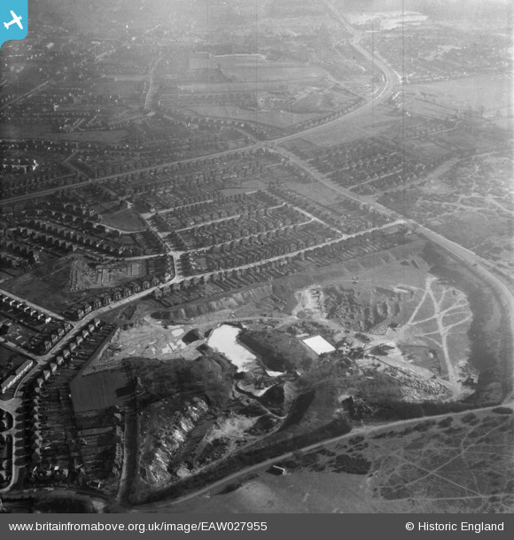
EAW027955 ENGLAND (1950). Crayford Sand and Gravel Pits Ltd Pit at Bowmans Estate and environs, Bowmans, 1950
© Copyright OpenStreetMap contributors and licensed by the OpenStreetMap Foundation. 2026. Cartography is licensed as CC BY-SA.
Nearby Images (6)
EAW027955

EAW027960

EAW027956

EAW027959

EAW027958

EAW027957

Details
| Title | [EAW027955] Crayford Sand and Gravel Pits Ltd Pit at Bowmans Estate and environs, Bowmans, 1950 |
| Reference | EAW027955 |
| Date | 14-February-1950 |
| Link | |
| Place name | BOWMANS |
| Parish | |
| District | |
| Country | ENGLAND |
| Easting / Northing | 552151, 173713 |
| Longitude / Latitude | 0.18949999040205, 51.441455665405 |
| National Grid Reference | TQ522737 |
Pins

KeithBexley |
Tuesday 3rd of September 2019 11:10:46 PM | |
|
KeithBexley |
Tuesday 3rd of September 2019 11:09:48 PM | |
|
SirTricky |
Saturday 5th of December 2015 08:10:18 AM | |
|
SirTricky |
Saturday 5th of December 2015 08:08:19 AM | |

Barney |
Tuesday 12th of May 2015 08:09:29 AM | |
|
Barney |
Tuesday 12th of May 2015 08:08:33 AM | |
|
Barney |
Tuesday 12th of May 2015 08:06:38 AM | |
|
Barney |
Tuesday 12th of May 2015 08:05:53 AM | |
|
Barney |
Tuesday 12th of May 2015 08:04:55 AM | |
|
Barney |
Tuesday 12th of May 2015 08:04:02 AM | |
|
Barney |
Tuesday 12th of May 2015 08:03:10 AM |