
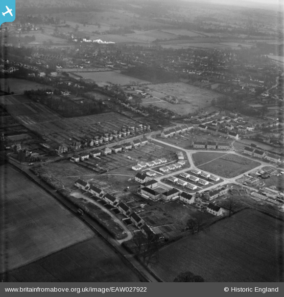
EAW027922 ENGLAND (1950). The residential area surrounding Phillimore Place and Willow Way under construction, Radlett, 1950
© Copyright OpenStreetMap contributors and licensed by the OpenStreetMap Foundation. 2026. Cartography is licensed as CC BY-SA.
Nearby Images (4)
EAW027922

 0°
0m
0°
0m
EAW027920
 178°
124m
178°
124m
EAW027921
 270°
185m
270°
185m
EAW027923
 238°
220m
238°
220m
Details
| Title | [EAW027922] The residential area surrounding Phillimore Place and Willow Way under construction, Radlett, 1950 |
| Reference | EAW027922 |
| Date | 8-February-1950 |
| Link | |
| Place name | RADLETT |
| Parish | ALDENHAM |
| District | |
| Country | ENGLAND |
| Easting / Northing | 515494, 199268 |
| Longitude / Latitude | -0.32932972201593, 51.679822747839 |
| National Grid Reference | TQ155993 |
Pins
 Prefabs Prefabs |

John W |
Friday 22nd of July 2016 08:46:20 PM |
| Bus on Watford Road heading for Radlett |
John W |
Friday 22nd of July 2016 08:45:38 PM |
| Steam train, heading south through Radlett . . . |
Steve Wilcox |
Saturday 5th of December 2015 07:48:35 PM |
 Junction Watford Road Willow Way Radlett. I'm pretty sure the van is a Ford 100e (aka Ford Thames 300E) so this postcard is dated post 1954-5. Junction Watford Road Willow Way Radlett. I'm pretty sure the van is a Ford 100e (aka Ford Thames 300E) so this postcard is dated post 1954-5. |
Bluid |
Thursday 29th of October 2015 01:01:06 AM |