
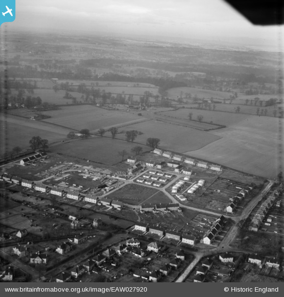
EAW027920 ENGLAND (1950). The residential area surrounding Phillimore Place and Kendals Close under construction, Radlett, from the east, 1950
© Copyright OpenStreetMap contributors and licensed by the OpenStreetMap Foundation. 2026. Cartography is licensed as CC BY-SA.
Nearby Images (4)
EAW027920

 0°
0m
0°
0m
EAW027922
 358°
124m
358°
124m
EAW027923
 272°
192m
272°
192m
EAW027921
 303°
226m
303°
226m
Details
| Title | [EAW027920] The residential area surrounding Phillimore Place and Kendals Close under construction, Radlett, from the east, 1950 |
| Reference | EAW027920 |
| Date | 8-February-1950 |
| Link | |
| Place name | RADLETT |
| Parish | ALDENHAM |
| District | |
| Country | ENGLAND |
| Easting / Northing | 515499, 199144 |
| Longitude / Latitude | -0.32929845554416, 51.678707157136 |
| National Grid Reference | TQ155991 |
Pins
 Willow Way Willow Way |

John W |
Friday 22nd of July 2016 08:37:10 PM |
| Fair Field Junior school was built here at a later date. |
John W |
Friday 22nd of July 2016 08:36:27 PM |
| New Road |
John W |
Friday 22nd of July 2016 08:35:27 PM |
| Watford Road |
John W |
Friday 22nd of July 2016 08:35:04 PM |
| Prefabs |
John W |
Friday 22nd of July 2016 08:33:23 PM |
| Blackbird Farm |
.jpg.jpg)
Daryl G Morrissey |
Tuesday 9th of February 2016 04:05:25 PM |
 Junction Watford Road Willow Way Radlett. I'm pretty sure the van is a Ford 100e (aka Ford Thames 300e) so this postcard can be dated as post 1954-5. Junction Watford Road Willow Way Radlett. I'm pretty sure the van is a Ford 100e (aka Ford Thames 300e) so this postcard can be dated as post 1954-5. |
Bluid |
Thursday 29th of October 2015 03:41:45 PM |
User Comment Contributions
It would be more accurate to describe this as a view from the South East. |
John W |
Friday 22nd of July 2016 08:38:01 PM |