
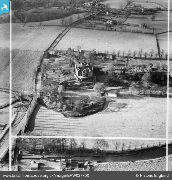
EAW027700 ENGLAND (1949). Stourton Castle, Stourton, 1949. This image was marked by Aerofilms Ltd for photo editing.
© Copyright OpenStreetMap contributors and licensed by the OpenStreetMap Foundation. 2026. Cartography is licensed as CC BY-SA.
Nearby Images (7)
EAW027700

EAW027702

EAW027705

EAW027701

EAW027703

EAW027704

EAW027706

Details
| Title | [EAW027700] Stourton Castle, Stourton, 1949. This image was marked by Aerofilms Ltd for photo editing. |
| Reference | EAW027700 |
| Date | 22-November-1949 |
| Link | |
| Place name | STOURTON |
| Parish | KINVER |
| District | |
| Country | ENGLAND |
| Easting / Northing | 385943, 284937 |
| Longitude / Latitude | -2.2069175355071, 52.461825915612 |
| National Grid Reference | SO859849 |
Pins

Matt Aldred edob.mattaldred.com |
Wednesday 9th of April 2025 02:47:32 PM | |

John W |
Sunday 19th of June 2016 02:32:51 PM | |
|
Steve Nicholls |
Friday 4th of September 2015 01:56:40 PM | |
|
MB |
Thursday 27th of February 2014 07:10:58 PM | |
|
MB |
Thursday 27th of February 2014 07:09:56 PM | |
|
MB |
Thursday 27th of February 2014 07:08:56 PM | |
On the River Stour |
John W |
Sunday 19th of June 2016 02:33:25 PM |
|
MB |
Thursday 27th of February 2014 07:08:15 PM | |
|
MB |
Thursday 27th of February 2014 07:07:27 PM | |
Stewponey Lock |
John W |
Sunday 19th of June 2016 02:32:09 PM |