
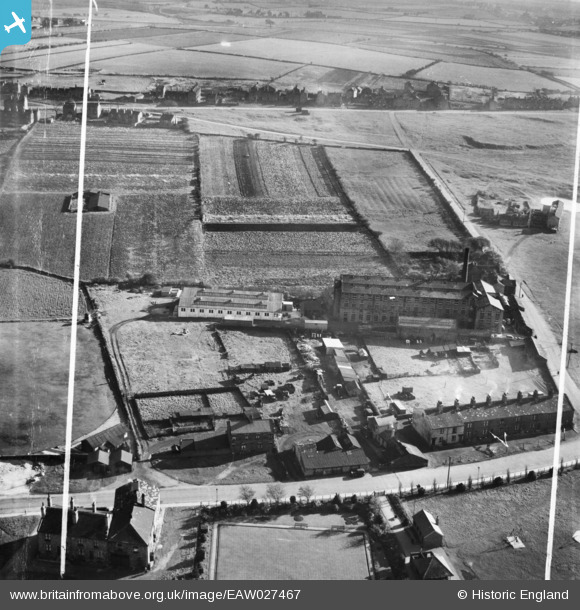
EAW027467 ENGLAND (1949). The Moorland Woollen Mills, Drighlington, 1949. This image was marked by Aerofilms Ltd for photo editing.
© Copyright OpenStreetMap contributors and licensed by the OpenStreetMap Foundation. 2026. Cartography is licensed as CC BY-SA.
Nearby Images (7)
EAW027467

EAW027468

EAW027466

EAW027470

EAW027471

EAW027469

EAW027465

Details
| Title | [EAW027467] The Moorland Woollen Mills, Drighlington, 1949. This image was marked by Aerofilms Ltd for photo editing. |
| Reference | EAW027467 |
| Date | 27-October-1949 |
| Link | |
| Place name | DRIGHLINGTON |
| Parish | DRIGHLINGTON |
| District | |
| Country | ENGLAND |
| Easting / Northing | 422323, 428712 |
| Longitude / Latitude | -1.6614074956827, 53.754073787292 |
| National Grid Reference | SE223287 |
Pins
Be the first to add a comment to this image!