
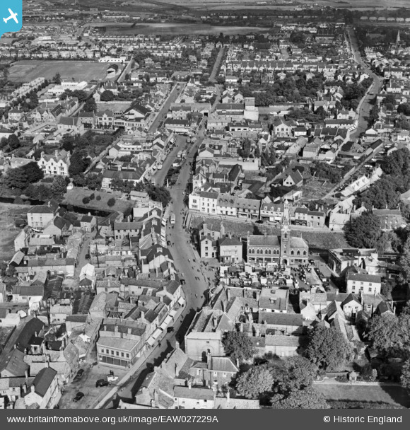
EAW027229A ENGLAND (1949). The Town Hall, Broad Street and the town centre, March, 1949
© Copyright OpenStreetMap contributors and licensed by the OpenStreetMap Foundation. 2026. Cartography is licensed as CC BY-SA.
Nearby Images (9)
EAW027229A

EAW027224

EAW027225

EAW027227

EPW013054

EAW027229

EAW027226

EAW027228
, March, 1949")
EPW013053

Details
| Title | [EAW027229A] The Town Hall, Broad Street and the town centre, March, 1949 |
| Reference | EAW027229A |
| Date | 12-October-1949 |
| Link | |
| Place name | MARCH |
| Parish | MARCH |
| District | |
| Country | ENGLAND |
| Easting / Northing | 541695, 296711 |
| Longitude / Latitude | 0.09000454232544, 52.549416664354 |
| National Grid Reference | TL417967 |
Pins
Be the first to add a comment to this image!