
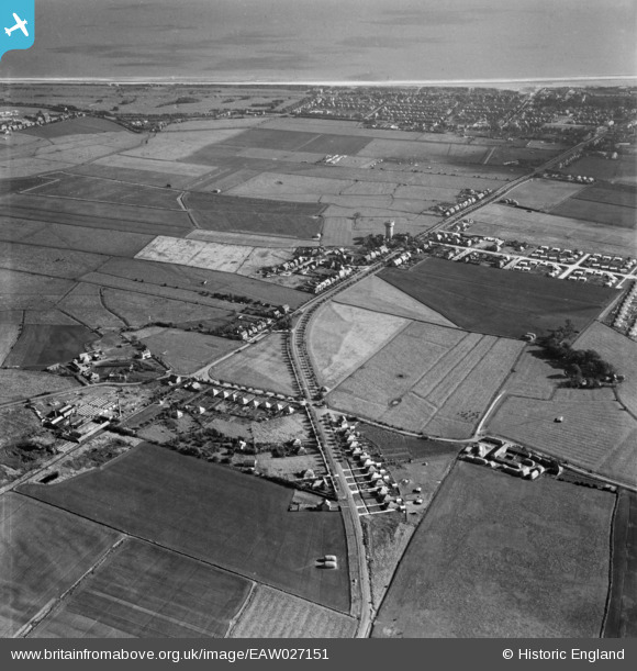
EAW027151 ENGLAND (1949). Burgh Road and the surrounding area, Skegness, 1949
© Copyright OpenStreetMap contributors and licensed by the OpenStreetMap Foundation. 2026. Cartography is licensed as CC BY-SA.
Nearby Images (4)
EAW027151

EAW027153

EAW027152

EAW027155

Details
| Title | [EAW027151] Burgh Road and the surrounding area, Skegness, 1949 |
| Reference | EAW027151 |
| Date | 12-October-1949 |
| Link | |
| Place name | SKEGNESS |
| Parish | SKEGNESS |
| District | |
| Country | ENGLAND |
| Easting / Northing | 555431, 364498 |
| Longitude / Latitude | 0.3247646649363, 53.154608340317 |
| National Grid Reference | TF554645 |
Pins
User Comment Contributions
The triangle area at the centre left is where the Welcome Inn was built in about 1956. The bungalows under the triangle are on Old Burgh Road. |

Geogboy |
Tuesday 4th of March 2014 02:38:39 PM |