
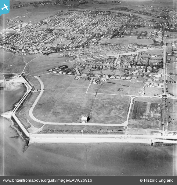
EAW026916 ENGLAND (1949). Western Esplanade and the surrounding residential area, Canvey Island, 1949
© Copyright OpenStreetMap contributors and licensed by the OpenStreetMap Foundation. 2026. Cartography is licensed as CC BY-SA.
Nearby Images (10)
EAW026916

EAW045324

EAW045323

EAW045304

EAW045325

EAW051014

EAW051015

EAW045336

EAW045322

EAW051054

Details
| Title | [EAW026916] Western Esplanade and the surrounding residential area, Canvey Island, 1949 |
| Reference | EAW026916 |
| Date | 2-October-1949 |
| Link | |
| Place name | CANVEY ISLAND |
| Parish | CANVEY ISLAND |
| District | |
| Country | ENGLAND |
| Easting / Northing | 579824, 182616 |
| Longitude / Latitude | 0.59185153648771, 51.513325410922 |
| National Grid Reference | TQ798826 |
Pins

redmist |
Sunday 29th of January 2023 10:13:28 AM |