
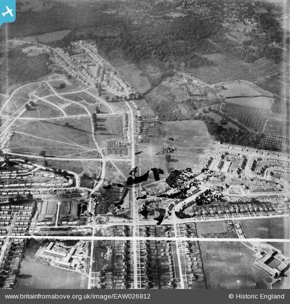
EAW026812 ENGLAND (1949). Housing estate under construction at St Paul's Cray, Bromley, 1949. This image has been produced from a damaged negative.
© Copyright OpenStreetMap contributors and licensed by the OpenStreetMap Foundation. 2026. Cartography is licensed as CC BY-SA.
Nearby Images (4)
EAW026812

EAW020726

EAW021757

EAW021755

Details
| Title | [EAW026812] Housing estate under construction at St Paul's Cray, Bromley, 1949. This image has been produced from a damaged negative. |
| Reference | EAW026812 |
| Date | 3-October-1949 |
| Link | |
| Place name | BROMLEY |
| Parish | |
| District | |
| Country | ENGLAND |
| Easting / Northing | 546348, 169880 |
| Longitude / Latitude | 0.10447136124209, 51.408539558518 |
| National Grid Reference | TQ463699 |
Pins

Matt Aldred edob.mattaldred.com |
Tuesday 8th of April 2025 01:20:09 PM |