
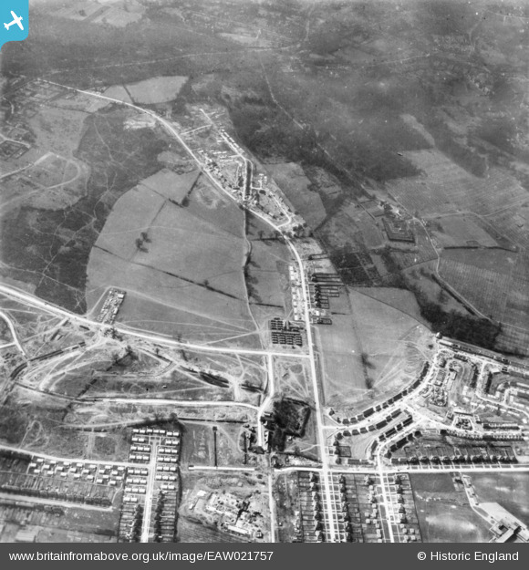
EAW021757 ENGLAND (1949). Housing estate under construction, St Paul's Cray, 1949. This image has been produced from a print.
© Copyright OpenStreetMap contributors and licensed by the OpenStreetMap Foundation. 2026. Cartography is licensed as CC BY-SA.
Nearby Images (4)
EAW021757

EAW020727

EAW021756

EAW026812

Details
| Title | [EAW021757] Housing estate under construction, St Paul's Cray, 1949. This image has been produced from a print. |
| Reference | EAW021757 |
| Date | 1-April-1949 |
| Link | |
| Place name | ST PAUL'S CRAY |
| Parish | |
| District | |
| Country | ENGLAND |
| Easting / Northing | 546169, 169738 |
| Longitude / Latitude | 0.10184068746288, 51.407309635686 |
| National Grid Reference | TQ462697 |
Pins
Be the first to add a comment to this image!