
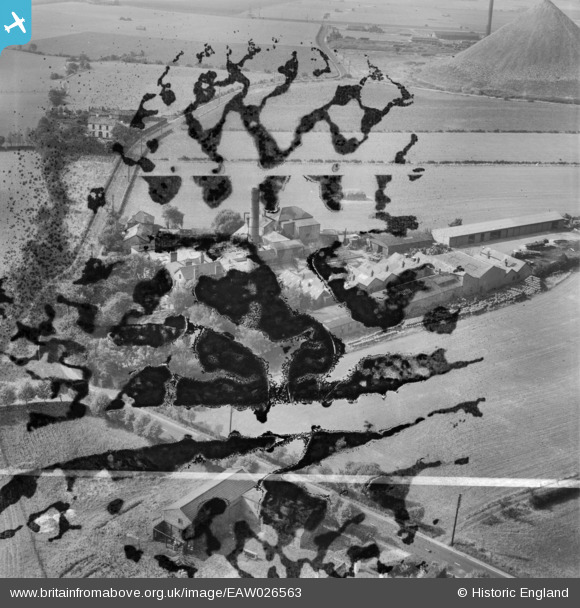
EAW026563 ENGLAND (1949). Burtonwood Brewery, Burtonwood, 1949. This image has been produced from a damaged negative.
© Copyright OpenStreetMap contributors and licensed by the OpenStreetMap Foundation. 2026. Cartography is licensed as CC BY-SA.
Nearby Images (13)
EAW026563

EAW026570

EAW026567

EAW026568

EAW026571

EAW026569

EAW026566

EAW012351

EAW012350

EAW026564

EAW026565

EAW026562

EAW012352

Details
| Title | [EAW026563] Burtonwood Brewery, Burtonwood, 1949. This image has been produced from a damaged negative. |
| Reference | EAW026563 |
| Date | 10-September-1949 |
| Link | |
| Place name | BURTONWOOD |
| Parish | BURTONWOOD AND WESTBROOK |
| District | |
| Country | ENGLAND |
| Easting / Northing | 355621, 393565 |
| Longitude / Latitude | -2.6681131649864, 53.436736179623 |
| National Grid Reference | SJ556936 |
Pins
Be the first to add a comment to this image!