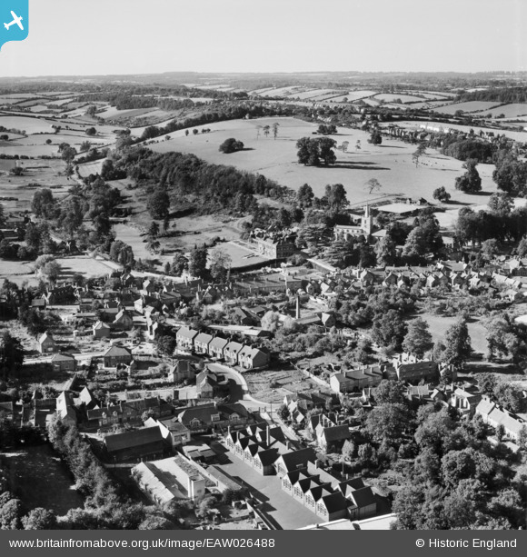
EAW026488 ENGLAND (1949). Chesham Park and Pednormead End, Chesham, from the south-east, 1949
© Copyright OpenStreetMap contributors and licensed by the OpenStreetMap Foundation. 2025. Cartography is licensed as CC BY-SA.
Details
| Title | [EAW026488] Chesham Park and Pednormead End, Chesham, from the south-east, 1949 |
| Reference | EAW026488 |
| Date | 10-September-1949 |
| Link | |
| Place name | CHESHAM |
| Parish | CHESHAM |
| District | |
| Country | ENGLAND |
| Easting / Northing | 495753, 201277 |
| Longitude / Latitude | -0.61424104160228, 51.701596504395 |
| National Grid Reference | SP958013 |
Pins
Be the first to add a comment to this image!
User Comment Contributions
Thomas Harding School in foreground left |

Aeronut |
Monday 28th of April 2014 11:46:58 AM |


![[EAW026488] Chesham Park and Pednormead End, Chesham, from the south-east, 1949](http://britainfromabove.org.uk/sites/all/libraries/aerofilms-images/public/100x100/EAW/026/EAW026488.jpg)
![[EAW026487] St Mary's Church and the town, Chesham, from the south-west, 1949](http://britainfromabove.org.uk/sites/all/libraries/aerofilms-images/public/100x100/EAW/026/EAW026487.jpg)
![[EPW056450] Red Lion Street and environs, Chesham, 1938](http://britainfromabove.org.uk/sites/all/libraries/aerofilms-images/public/100x100/EPW/056/EPW056450.jpg)