
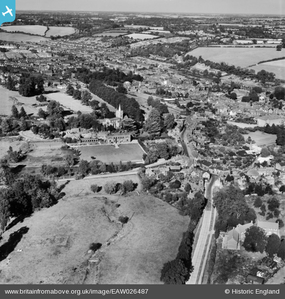
EAW026487 ENGLAND (1949). St Mary's Church and the town, Chesham, from the south-west, 1949
© Copyright OpenStreetMap contributors and licensed by the OpenStreetMap Foundation. 2025. Cartography is licensed as CC BY-SA.
Nearby Images (4)
EAW026487

EAW026488

EAW026486

EPW018381

Details
| Title | [EAW026487] St Mary's Church and the town, Chesham, from the south-west, 1949 |
| Reference | EAW026487 |
| Date | 10-September-1949 |
| Link | |
| Place name | CHESHAM |
| Parish | CHESHAM |
| District | |
| Country | ENGLAND |
| Easting / Northing | 495542, 201330 |
| Longitude / Latitude | -0.61727919613073, 51.702108922575 |
| National Grid Reference | SP955013 |
Pins

totoro |
Thursday 27th of November 2014 09:54:20 PM | |
|
totoro |
Thursday 27th of November 2014 09:45:57 PM | |
|
totoro |
Thursday 27th of November 2014 09:36:25 PM | |
|
totoro |
Thursday 27th of November 2014 09:35:55 PM | |
|
totoro |
Thursday 27th of November 2014 09:33:20 PM | |
|
totoro |
Thursday 27th of November 2014 09:31:24 PM | |
|
totoro |
Thursday 27th of November 2014 09:30:35 PM |