
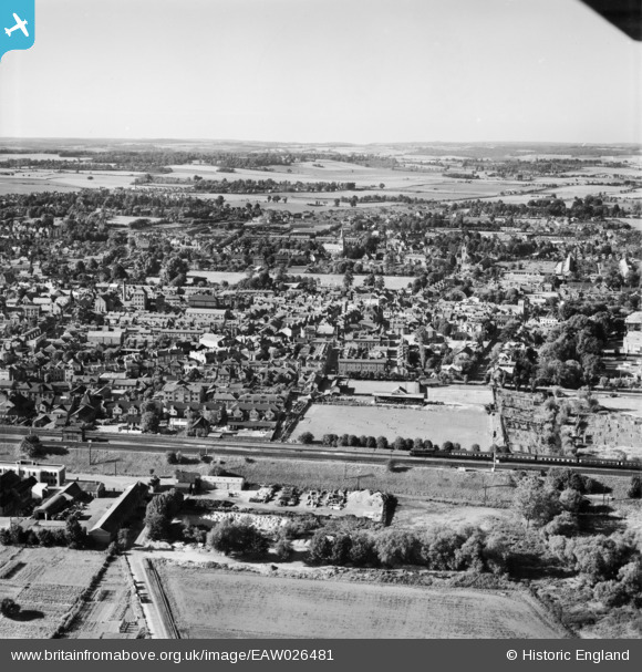
EAW026481 ENGLAND (1949). Maidenhead Football Ground (York Road) and the town, Maidenhead, from the south, 1949
© Copyright OpenStreetMap contributors and licensed by the OpenStreetMap Foundation. 2025. Cartography is licensed as CC BY-SA.
Nearby Images (4)
EAW026481
 and the town, Maidenhead, from the south, 1949")
EPW000905

EPW022623

EPW022624

Details
| Title | [EAW026481] Maidenhead Football Ground (York Road) and the town, Maidenhead, from the south, 1949 |
| Reference | EAW026481 |
| Date | 10-September-1949 |
| Link | |
| Place name | MAIDENHEAD |
| Parish | |
| District | |
| Country | ENGLAND |
| Easting / Northing | 489015, 180792 |
| Longitude / Latitude | -0.71693055224777, 51.518544404859 |
| National Grid Reference | SU890808 |
Pins
 misterjohn |
Tuesday 3rd of January 2023 11:30:59 AM | |
Isleworth1961 |
Saturday 24th of February 2018 04:54:05 PM |