
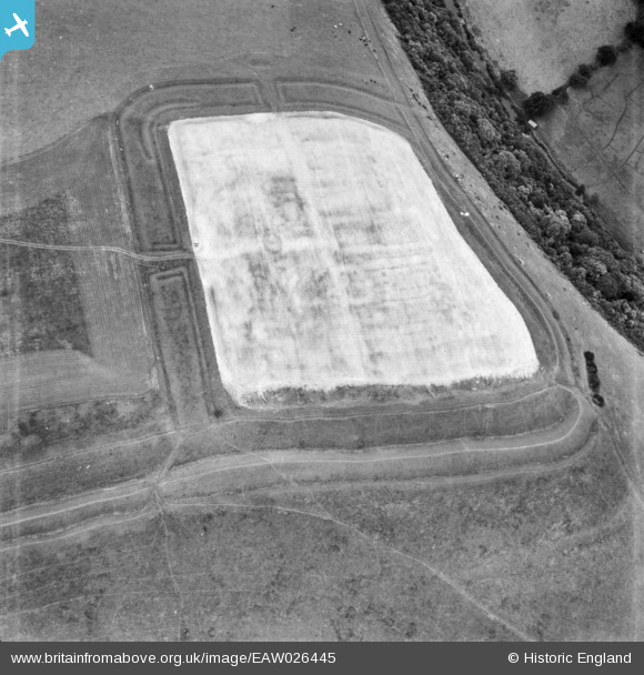
EAW026445 ENGLAND (1949). Hod Hill Roman Fort, Hod Hill, 1949
© Copyright OpenStreetMap contributors and licensed by the OpenStreetMap Foundation. 2026. Cartography is licensed as CC BY-SA.
Nearby Images (5)
EAW026445

EAW026444

EAW026442

EAW026443

EAW026441

Details
| Title | [EAW026445] Hod Hill Roman Fort, Hod Hill, 1949 |
| Reference | EAW026445 |
| Date | 8-September-1949 |
| Link | |
| Place name | HOD HILL |
| Parish | STOURPAINE |
| District | |
| Country | ENGLAND |
| Easting / Northing | 385535, 110821 |
| Longitude / Latitude | -2.2057043316673, 50.896133977502 |
| National Grid Reference | ST855108 |
Pins
Be the first to add a comment to this image!
User Comment Contributions
This photo is quite deceptive in that it only shows a quarter of the Hod Hill fort. Please compare it with the other photos in the series and the attached photo from Crawford & Keiller's book of 1928. |

Class31 |
Thursday 13th of February 2014 12:19:36 PM |
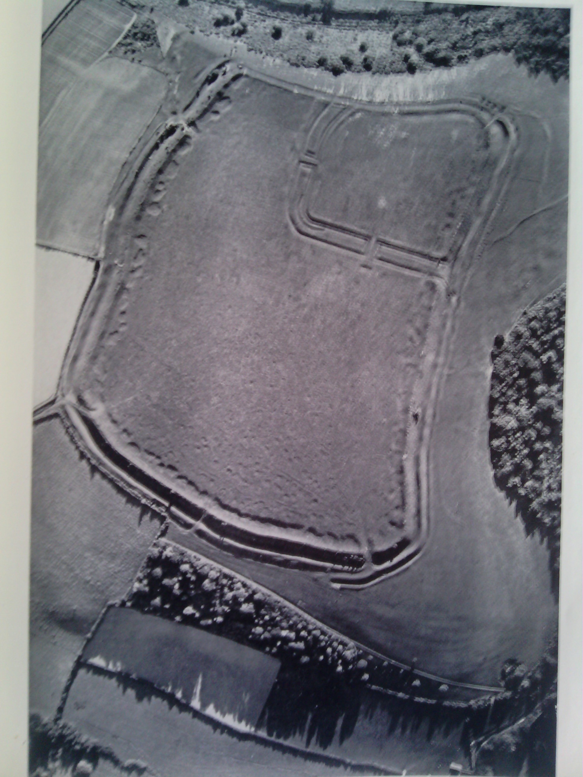
Please see the photo copied from Wessex From the Air Oxford 1928 Crawford & Keiller. Notice the way in which the features are highlighted in this photo. |
Class31 |
Thursday 13th of February 2014 11:54:14 AM |
Interesting. Roman forts usually have four entrances/exits. This one oly has two. But then it is in a corner of an Iron Age hillfort and on the other two sides the land falls away sharply |

MB |
Thursday 13th of February 2014 11:30:14 AM |