
EAW026443 ENGLAND (1949). Hod Hill Roman Fort, Hod Hill, 1949

© Copyright OpenStreetMap contributors and licensed by the OpenStreetMap Foundation. 2026. Cartography is licensed as CC BY-SA.
Nearby Images (5)
EAW026443

EAW026442

EAW026444

EAW026445

EAW026441

Details
| Title | [EAW026443] Hod Hill Roman Fort, Hod Hill, 1949 |
| Reference | EAW026443 |
| Date | 8-September-1949 |
| Link | |
| Place name | HOD HILL |
| Parish | STOURPAINE |
| District | |
| Country | ENGLAND |
| Easting / Northing | 385464, 110737 |
| Longitude / Latitude | -2.2067106594195, 50.895376750328 |
| National Grid Reference | ST855107 |
Pins
Be the first to add a comment to this image!
User Comment Contributions
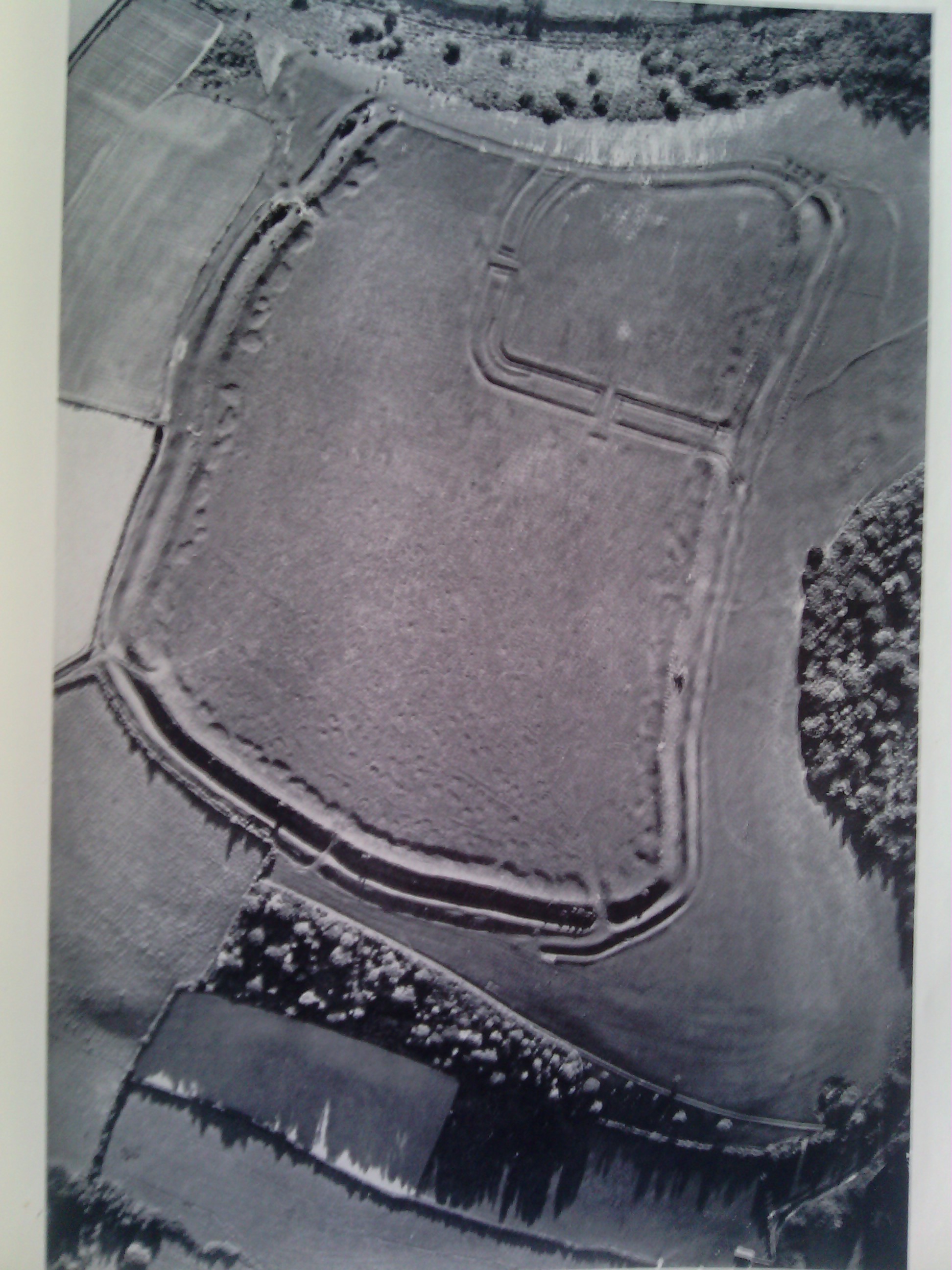
Please see the photo copied from Wessex From the Air Oxford 1928 Crawford & Keiller. Notice the way in which the features are highlighted in this photo. |

Class31 |
Thursday 13th of February 2014 12:34:13 PM |
This photo is quite deceptive in that it only shows a quarter of the Hod Hill fort. Please compare it with the other photos in the series and the attached photo from Crawford & Keiller's book of 1928. |
Class31 |
Thursday 13th of February 2014 12:20:26 PM |