
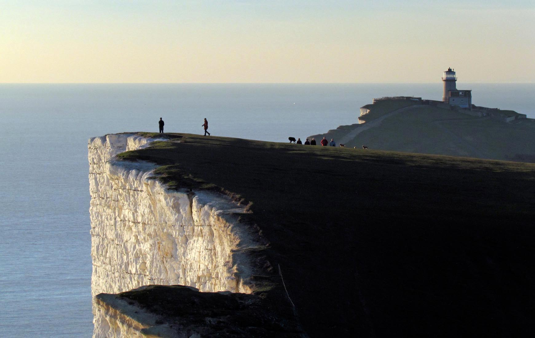
EAW026331 ENGLAND (1949). Beachy Head Lighthouse and cliffs, Beachy Head, from the south-east, 1949

© Copyright OpenStreetMap contributors and licensed by the OpenStreetMap Foundation. 2026. Cartography is licensed as CC BY-SA.
Nearby Images (18)
EAW026331

EAW037828

EAW026332

EAW037827

EAW022966

EPW051357

EPW051358

EAW011403

EPW035315

EAW026328

EAW011402

EPW035314

EAW011401

EAW022964

EPW051359

EAW011400

EAW026330

EAW011404

Details
| Title | [EAW026331] Beachy Head Lighthouse and cliffs, Beachy Head, from the south-east, 1949 |
| Reference | EAW026331 |
| Date | 5-September-1949 |
| Link | |
| Place name | BEACHY HEAD |
| Parish | |
| District | |
| Country | ENGLAND |
| Easting / Northing | 558361, 95151 |
| Longitude / Latitude | 0.24434396227749, 50.7337848683 |
| National Grid Reference | TV584952 |
Pins

Alan McFaden |
Sunday 31st of August 2014 10:39:09 AM | |
|
Alan McFaden |
Sunday 31st of August 2014 10:38:45 AM | |

bescotbeast |
Friday 28th of February 2014 06:13:13 PM | |
|
bescotbeast |
Friday 28th of February 2014 06:12:49 PM | |
|
bescotbeast |
Friday 28th of February 2014 06:11:21 PM | |
|
bescotbeast |
Friday 28th of February 2014 06:10:57 PM |


User Comment Contributions

Birling Gap 2014 |
Alan McFaden |
Sunday 31st of August 2014 10:40:39 AM |
Belle Tout Lighthouse |
Alan McFaden |
Sunday 31st of August 2014 10:40:07 AM |
Beachy Head Lighthouse |
Alan McFaden |
Sunday 31st of August 2014 10:39:34 AM |