
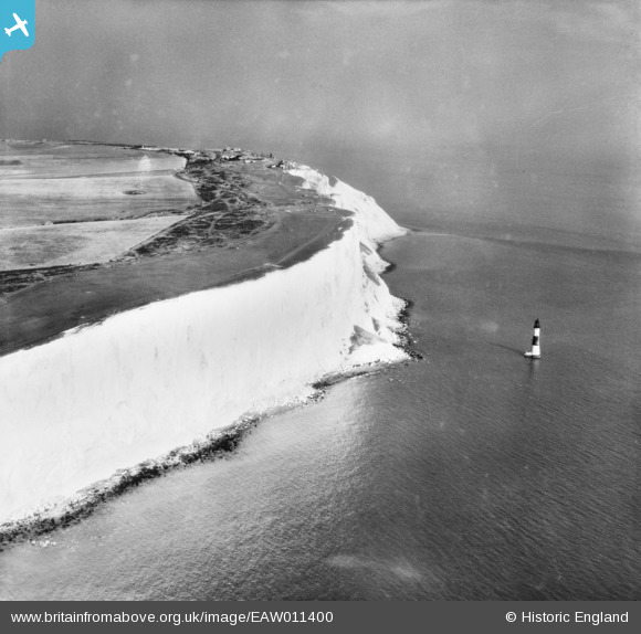
EAW011400 ENGLAND (1947). Beachy Head Lighthouse and the cliffs, Beachy Head, 1947
© Copyright OpenStreetMap contributors and licensed by the OpenStreetMap Foundation. 2026. Cartography is licensed as CC BY-SA.
Nearby Images (16)
EAW011400

EAW011401

EAW026328

EPW035314

EAW022966

EAW011402

EAW037827

EAW026332

EAW026330

EPW035315

EAW011403

EAW026331

EAW037828

EPW051357

EPW051359

EPW051358

Details
| Title | [EAW011400] Beachy Head Lighthouse and the cliffs, Beachy Head, 1947 |
| Reference | EAW011400 |
| Date | 1-October-1947 |
| Link | |
| Place name | BEACHY HEAD |
| Parish | |
| District | |
| Country | ENGLAND |
| Easting / Northing | 558187, 95245 |
| Longitude / Latitude | 0.24192033818921, 50.73467704755 |
| National Grid Reference | TV582952 |
Pins

cptpies |
Thursday 28th of November 2013 09:40:42 AM | |

Alan McFaden |
Monday 11th of November 2013 07:19:01 PM | |
|
Alan McFaden |
Monday 11th of November 2013 07:16:55 PM | |
The picture is very nice but I feel that too many pins showing modern views are now cluttering a lot of these historical shots. The pin and comment about the Chain Home Radar is the kind of thing people want to see. |
Mikeo1938 |
Monday 6th of October 2014 01:18:33 PM |

