
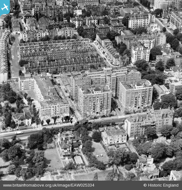
EAW025334 ENGLAND (1949). Grove Hall Court, St John's Wood, 1949. This image has been produced from a damaged negative.
© Copyright OpenStreetMap contributors and licensed by the OpenStreetMap Foundation. 2026. Cartography is licensed as CC BY-SA.
Nearby Images (10)
EAW025334

EAW025339

EAW025335

EAW025338

EAW025336

EAW025337

EAW025333

EPW045411

EAW018356

EAW021740

Details
| Title | [EAW025334] Grove Hall Court, St John's Wood, 1949. This image has been produced from a damaged negative. |
| Reference | EAW025334 |
| Date | 22-July-1949 |
| Link | |
| Place name | ST JOHN'S WOOD |
| Parish | |
| District | |
| Country | ENGLAND |
| Easting / Northing | 526473, 182829 |
| Longitude / Latitude | -0.17652704181508, 51.529707308442 |
| National Grid Reference | TQ265828 |
Pins

rawanhussin |
Monday 7th of October 2024 06:09:20 PM | |
|
Chelsea61 |
Monday 24th of March 2014 05:49:37 PM | |
|
Chelsea61 |
Monday 24th of March 2014 05:49:07 PM |