
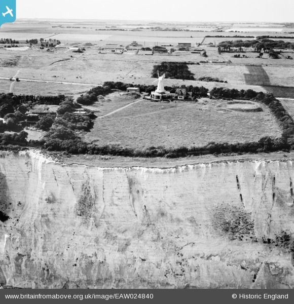
EAW024840 ENGLAND (1949). The windmill, South Foreland, 1949
© Copyright OpenStreetMap contributors and licensed by the OpenStreetMap Foundation. 2026. Cartography is licensed as CC BY-SA.
Nearby Images (5)
EAW024840

EAW024835

EPW035426

EAW020462

EAW020461

Details
| Title | [EAW024840] The windmill, South Foreland, 1949 |
| Reference | EAW024840 |
| Date | 12-July-1949 |
| Link | |
| Place name | SOUTH FORELAND |
| Parish | ST. MARGARET'S AT CLIFFE |
| District | |
| Country | ENGLAND |
| Easting / Northing | 636329, 143440 |
| Longitude / Latitude | 1.3789458806348, 51.140839743581 |
| National Grid Reference | TR363434 |
Pins

Chris Kolonko |
Saturday 16th of September 2017 08:29:00 PM | |
|
MB |
Sunday 22nd of December 2013 10:31:16 AM |
User Comment Contributions
WWII Coast Artillery Battery. South Foreland. |
cptpies |
Thursday 9th of January 2014 09:29:07 AM |