
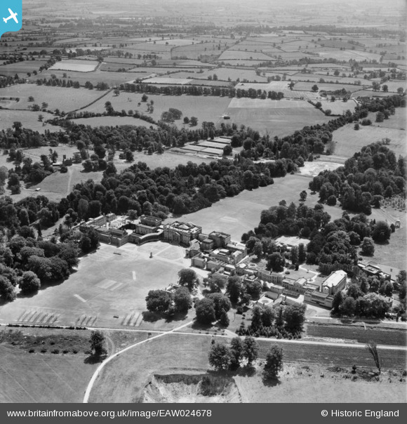
EAW024678 ENGLAND (1949). Stowe House (School) and Park, Dadford, from the north-west, 1949
© Copyright OpenStreetMap contributors and licensed by the OpenStreetMap Foundation. 2026. Cartography is licensed as CC BY-SA.
Nearby Images (7)
EAW024678
 and Park, Dadford, from the north-west, 1949")
EAW024681
 and Park, Dadford, 1949. This image has been produced from a print.")
EAW024679
 and St Mary's Church, Dadford, 1949")
EAW013470

EAW013472

EAW013473

EAW024680
 and Park, Dadford, from the south-east, 1949")
Details
| Title | [EAW024678] Stowe House (School) and Park, Dadford, from the north-west, 1949 |
| Reference | EAW024678 |
| Date | 12-July-1949 |
| Link | |
| Place name | DADFORD |
| Parish | STOWE |
| District | |
| Country | ENGLAND |
| Easting / Northing | 467250, 237532 |
| Longitude / Latitude | -1.0196028584795, 52.031692754054 |
| National Grid Reference | SP673375 |
Pins
Be the first to add a comment to this image!
User Comment Contributions

Stowe School 11/04/2014 |

Class31 |
Monday 14th of April 2014 12:57:02 PM |