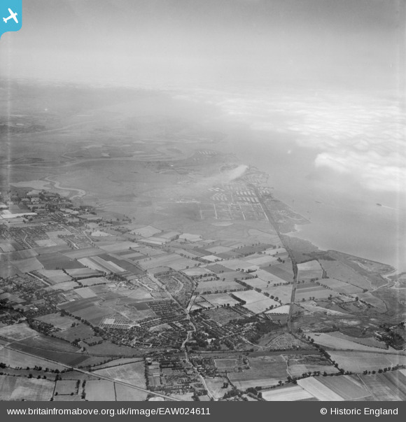
EAW024611 ENGLAND (1949). The town and Shell Haven Oil Refinery, Stanford-le-Hope, from the west, 1949
© Copyright OpenStreetMap contributors and licensed by the OpenStreetMap Foundation. 2026. Cartography is licensed as CC BY-SA.
Nearby Images (5)
Details
| Title | [EAW024611] The town and Shell Haven Oil Refinery, Stanford-le-Hope, from the west, 1949 |
| Reference | EAW024611 |
| Date | 11-July-1949 |
| Link | |
| Place name | STANFORD-LE-HOPE |
| Parish | |
| District | |
| Country | ENGLAND |
| Easting / Northing | 569382, 182235 |
| Longitude / Latitude | 0.4413166007204, 51.513129866547 |
| National Grid Reference | TQ694822 |
Pins

Corringham Light Railway |
Tuesday 17th of December 2024 08:07:51 PM | |

Corringham Light Railway |
Tuesday 17th of December 2024 08:07:26 PM | |

Corringham Light Railway |
Tuesday 17th of December 2024 08:06:59 PM | |

Corringham Light Railway |
Tuesday 17th of December 2024 08:06:29 PM | |

Corringham Light Railway |
Tuesday 17th of December 2024 08:05:56 PM | |

Corringham Light Railway |
Tuesday 17th of December 2024 08:04:40 PM | |

Corringham Light Railway |
Tuesday 17th of December 2024 08:04:11 PM | |

Bandon |
Wednesday 23rd of March 2022 04:44:04 PM |


![[EAW024611] The town and Shell Haven Oil Refinery, Stanford-le-Hope, from the west, 1949](http://britainfromabove.org.uk/sites/all/libraries/aerofilms-images/public/100x100/EAW/024/EAW024611.jpg)
![[EAW024610] The town and Shell Haven Oil Refinery, Stanford-le-Hope, from the west, 1949. This image has been produced from a damaged negative.](http://britainfromabove.org.uk/sites/all/libraries/aerofilms-images/public/100x100/EAW/024/EAW024610.jpg)
![[EPW024903] Ivywall Farm and new housing under construction between Corringham Road and Billet Lane, Stanford-le-Hope, 1928](http://britainfromabove.org.uk/sites/all/libraries/aerofilms-images/public/100x100/EPW/024/EPW024903.jpg)
![[EPW024900] New housing under construction between Corringham Road and Billet Lane, Stanford-le-Hope, 1928](http://britainfromabove.org.uk/sites/all/libraries/aerofilms-images/public/100x100/EPW/024/EPW024900.jpg)
![[EPW024905] New housing under construction between Corringham Road and Billet Lane, Stanford-le-Hope, 1928](http://britainfromabove.org.uk/sites/all/libraries/aerofilms-images/public/100x100/EPW/024/EPW024905.jpg)