
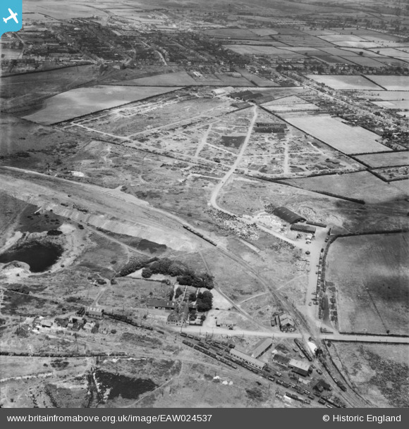
EAW024537 ENGLAND (1949). The site of the Cannock Chase Collieries, Chasetown, 1949
© Copyright OpenStreetMap contributors and licensed by the OpenStreetMap Foundation. 2026. Cartography is licensed as CC BY-SA.
Nearby Images (8)
EAW024537

EAW024536

EAW024541

EAW024535

EAW024533

EAW024542

EAW024532

EAW024540

Details
| Title | [EAW024537] The site of the Cannock Chase Collieries, Chasetown, 1949 |
| Reference | EAW024537 |
| Date | 8-July-1949 |
| Link | |
| Place name | CHASETOWN |
| Parish | BURNTWOOD |
| District | |
| Country | ENGLAND |
| Easting / Northing | 404040, 308477 |
| Longitude / Latitude | -1.940244474603, 52.673636990352 |
| National Grid Reference | SK040085 |
Pins

Class31 |
Wednesday 15th of October 2014 04:51:08 PM |
