
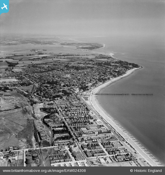
EAW024308 ENGLAND (1949). The town, Felixstowe, from the south-west, 1949
© Copyright OpenStreetMap contributors and licensed by the OpenStreetMap Foundation. 2026. Cartography is licensed as CC BY-SA.
Nearby Images (5)
EAW024308

EPW002005

EAW024307

EPW039284

EPW001920

Details
| Title | [EAW024308] The town, Felixstowe, from the south-west, 1949 |
| Reference | EAW024308 |
| Date | 4-July-1949 |
| Link | |
| Place name | FELIXSTOWE |
| Parish | FELIXSTOWE |
| District | |
| Country | ENGLAND |
| Easting / Northing | 629569, 233717 |
| Longitude / Latitude | 1.3413786382883, 51.954042894429 |
| National Grid Reference | TM296337 |
Pins

redmist |
Wednesday 10th of December 2025 08:28:37 PM | |
|
Post-war prefabs |
Monday 18th of November 2019 02:33:13 PM | |
|
Graham Yaxley |
Saturday 17th of January 2015 06:20:50 PM |