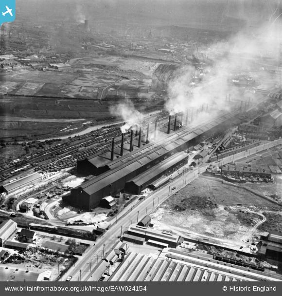
EAW024154 ENGLAND (1949). The Steel, Peech and Tozer Templeborough Steel Works, Templeborough, from the south-west, 1949
© Copyright OpenStreetMap contributors and licensed by the OpenStreetMap Foundation. 2026. Cartography is licensed as CC BY-SA.
Nearby Images (5)
Details
| Title | [EAW024154] The Steel, Peech and Tozer Templeborough Steel Works, Templeborough, from the south-west, 1949 |
| Reference | EAW024154 |
| Date | 22-June-1949 |
| Link | |
| Place name | TEMPLEBOROUGH |
| Parish | |
| District | |
| Country | ENGLAND |
| Easting / Northing | 440573, 391480 |
| Longitude / Latitude | -1.3894499592397, 53.418300692627 |
| National Grid Reference | SK406915 |
Pins

John Wass |
Wednesday 17th of August 2016 09:28:46 PM |


![[EAW024154] The Steel, Peech and Tozer Templeborough Steel Works, Templeborough, from the south-west, 1949](http://britainfromabove.org.uk/sites/all/libraries/aerofilms-images/public/100x100/EAW/024/EAW024154.jpg)
![[EAW029393] The Steel, Peech and Tozer Templeborough Steel Works, Ickles, 1950](http://britainfromabove.org.uk/sites/all/libraries/aerofilms-images/public/100x100/EAW/029/EAW029393.jpg)
![[EAW029398] The River Don and the Steel, Peech and Tozer Templeborough Steel Works, Ickles, 1950](http://britainfromabove.org.uk/sites/all/libraries/aerofilms-images/public/100x100/EAW/029/EAW029398.jpg)
![[EPW041703] The Templeborough Steel Works and environs, Rotherham, 1933](http://britainfromabove.org.uk/sites/all/libraries/aerofilms-images/public/100x100/EPW/041/EPW041703.jpg)
![[EAW025969] The Templeborough Steel Works, Templeborough, 1949. This image has been produced from a print.](http://britainfromabove.org.uk/sites/all/libraries/aerofilms-images/public/100x100/EAW/025/EAW025969.jpg)