
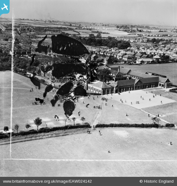
EAW024142 ENGLAND (1949). Queen Elizabeth's Grammar School (Boys), Mansfield, from the north-east, 1949. This image has been produced from a damaged negative.
© Copyright OpenStreetMap contributors and licensed by the OpenStreetMap Foundation. 2026. Cartography is licensed as CC BY-SA.
Nearby Images (8)
EAW024142
, Mansfield, from the north-east, 1949. This image has been produced from a damaged negative.")
EAW028616
 and Sports Ground, Mansfield Woodhouse, 1950. This image was marked by Aerofilms Ltd for photo editing.")
EAW028618
, Mansfield Woodhouse, 1950")
EAW028615
 and Sports Ground, Mansfield Woodhouse, 1950. This image was marked by Aerofilms Ltd for photo editing.")
EAW028617
, Mansfield Woodhouse, 1950. This image was marked by Aerofilms Ltd for photo editing.")
EAW024144
 and environs, Mansfield, 1949. This image has been produced from a print marked by Aerofilms Ltd for photo editing.")
EAW024145
, Mansfield, from the south-east, 1949. This image has been produced from a print marked by Aerofilms Ltd for photo editing.")
EAW024143
 and environs, Mansfield, 1949. This image has been produced from a print marked by Aerofilms Ltd for photo editing.")
Details
| Title | [EAW024142] Queen Elizabeth's Grammar School (Boys), Mansfield, from the north-east, 1949. This image has been produced from a damaged negative. |
| Reference | EAW024142 |
| Date | 22-June-1949 |
| Link | |
| Place name | MANSFIELD |
| Parish | |
| District | |
| Country | ENGLAND |
| Easting / Northing | 453352, 362402 |
| Longitude / Latitude | -1.2020522443533, 53.155783523354 |
| National Grid Reference | SK534624 |
Pins

WindyMiller |
Friday 13th of March 2020 09:15:14 PM | |
|
Berisford |
Friday 3rd of February 2017 05:22:40 PM | |
|
Berisford |
Friday 3rd of February 2017 05:21:32 PM |