
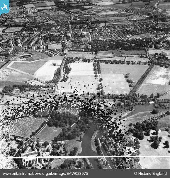
EAW023975 ENGLAND (1949). Agars Plough playing fields and environs, Eton, 1949. This image has been produced from a damaged negative.
© Copyright OpenStreetMap contributors and licensed by the OpenStreetMap Foundation. 2026. Cartography is licensed as CC BY-SA.
Nearby Images (3)
EAW023975

EAW006356

EPW049623

Details
| Title | [EAW023975] Agars Plough playing fields and environs, Eton, 1949. This image has been produced from a damaged negative. |
| Reference | EAW023975 |
| Date | 23-June-1949 |
| Link | |
| Place name | ETON |
| Parish | ETON |
| District | |
| Country | ENGLAND |
| Easting / Northing | 497181, 178478 |
| Longitude / Latitude | -0.5998992518026, 51.496395817946 |
| National Grid Reference | SU972785 |
Pins

designking |
Monday 14th of September 2020 11:08:24 PM | |
|
designking |
Monday 14th of September 2020 11:07:30 PM | |
|
designking |
Monday 14th of September 2020 11:06:39 PM | |
|
payitforwardeddie |
Saturday 5th of May 2018 02:33:16 PM | |
|
designking |
Saturday 13th of September 2014 04:00:07 PM | |
|
designking |
Saturday 13th of September 2014 03:58:53 PM | |
|
dave43 |
Friday 20th of December 2013 09:13:13 PM | |
|
dave43 |
Friday 20th of December 2013 09:12:44 PM | |
|
dave43 |
Friday 20th of December 2013 09:12:11 PM | |
|
dave43 |
Friday 20th of December 2013 09:10:29 PM | |
|
dave43 |
Friday 20th of December 2013 09:09:27 PM | |
perhaps that is the strange marks on the ground (the fair) |
dave43 |
Friday 20th of December 2013 09:11:17 PM |