
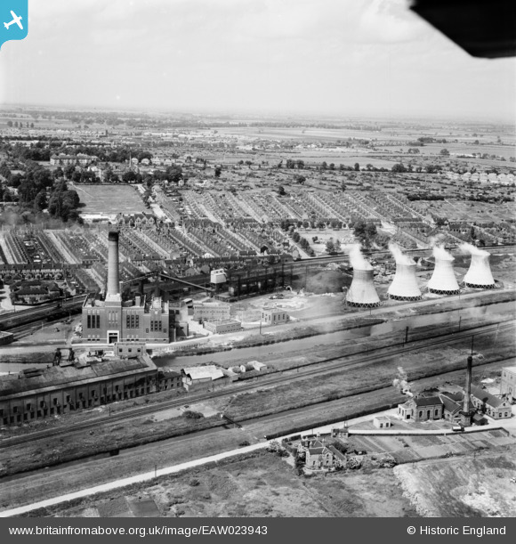
EAW023943 ENGLAND (1949). Spa Road Power Station, Lincoln, from the south, 1949
© Copyright OpenStreetMap contributors and licensed by the OpenStreetMap Foundation. 2026. Cartography is licensed as CC BY-SA.
Nearby Images (11)
EAW023943

EAW023940

EAW023944

EAW023941

EAW023942

EAW023946

EAW023938

EAW023939

EAW023945

EAW023947

EAW015721

Details
| Title | [EAW023943] Spa Road Power Station, Lincoln, from the south, 1949 |
| Reference | EAW023943 |
| Date | 20-June-1949 |
| Link | |
| Place name | LINCOLN |
| Parish | |
| District | |
| Country | ENGLAND |
| Easting / Northing | 498678, 370944 |
| Longitude / Latitude | -0.52169485266068, 53.226080574852 |
| National Grid Reference | SK987709 |
Pins

Ian |
Sunday 28th of November 2021 08:24:53 PM | |
|
Ian |
Sunday 28th of November 2021 08:24:12 PM | |
|
Ian |
Sunday 28th of November 2021 08:22:30 PM | |
|
Ian |
Sunday 28th of November 2021 08:20:37 PM | |
|
Ian |
Sunday 28th of November 2021 08:10:56 PM |