
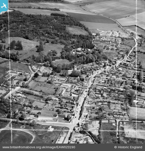
EAW023190 ENGLAND (1949). The High Street, Oxford Street and Wantage Road, Lambourn, 1949. This image was marked by Aerofilms Ltd for photo editing.
© Copyright OpenStreetMap contributors and licensed by the OpenStreetMap Foundation. 2026. Cartography is licensed as CC BY-SA.
Nearby Images (13)
EAW023190

EPW029317

EAW023189

EPW029320

EPW029318

EAW023188

EAW023193

EAW023194

EAW023192

EAW023191

EPW029319

EPW029316

EPW029315

Details
| Title | [EAW023190] The High Street, Oxford Street and Wantage Road, Lambourn, 1949. This image was marked by Aerofilms Ltd for photo editing. |
| Reference | EAW023190 |
| Date | 6-May-1949 |
| Link | |
| Place name | LAMBOURN |
| Parish | LAMBOURN |
| District | |
| Country | ENGLAND |
| Easting / Northing | 432601, 178953 |
| Longitude / Latitude | -1.5302017990143, 51.50808312488 |
| National Grid Reference | SU326790 |
Pins

Billy Turner |
Thursday 1st of December 2016 02:06:43 PM |
