
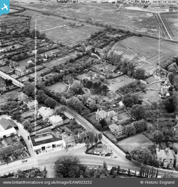
EAW023152 ENGLAND (1949). Barn House and adjacent properties on Joy Lane and the junction with Canterbury Road and Borstal Hill, Seasalter, 1949. This image was marked by Aerofilms Ltd for photo editing.
© Copyright OpenStreetMap contributors and licensed by the OpenStreetMap Foundation. 2026. Cartography is licensed as CC BY-SA.
Nearby Images (7)
EAW023152

EAW023151

EAW023150

EAW023149

EPW018618

EAW023154

EAW023153

Details
| Title | [EAW023152] Barn House and adjacent properties on Joy Lane and the junction with Canterbury Road and Borstal Hill, Seasalter, 1949. This image was marked by Aerofilms Ltd for photo editing. |
| Reference | EAW023152 |
| Date | 11-May-1949 |
| Link | |
| Place name | SEASALTER |
| Parish | |
| District | |
| Country | ENGLAND |
| Easting / Northing | 610402, 165646 |
| Longitude / Latitude | 1.0218870767822, 51.350375591788 |
| National Grid Reference | TR104656 |
Pins

Matt Aldred edob.mattaldred.com |
Tuesday 9th of March 2021 02:04:34 PM | |

Sparky |
Sunday 9th of December 2018 07:37:59 PM | |
|
Sparky |
Sunday 30th of July 2017 08:55:20 PM | |
|
Sparky |
Sunday 30th of July 2017 08:54:42 PM | |
|
Sparky |
Tuesday 11th of July 2017 10:22:36 PM | |
|
Sparky |
Tuesday 11th of July 2017 10:19:22 PM | |
|
Sparky |
Tuesday 11th of July 2017 10:18:13 PM | |
|
Sparky |
Tuesday 11th of July 2017 10:17:25 PM |