
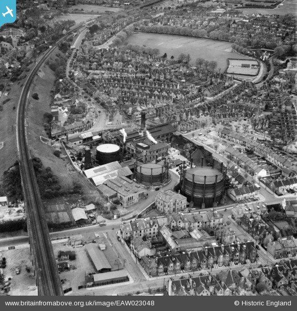
EAW023048 ENGLAND (1949). The Gas Works on Foord Road and environs, Folkestone, 1949
© Copyright OpenStreetMap contributors and licensed by the OpenStreetMap Foundation. 2026. Cartography is licensed as CC BY-SA.
Nearby Images (6)
EAW023048

EAW023051

EAW023052

EAW023049

EAW023053

EAW023050

Details
| Title | [EAW023048] The Gas Works on Foord Road and environs, Folkestone, 1949 |
| Reference | EAW023048 |
| Date | 10-May-1949 |
| Link | |
| Place name | FOLKESTONE |
| Parish | FOLKESTONE |
| District | |
| Country | ENGLAND |
| Easting / Northing | 622579, 136462 |
| Longitude / Latitude | 1.1783824980332, 51.083693461764 |
| National Grid Reference | TR226365 |
Pins

Sparky |
Monday 28th of August 2017 11:00:14 AM | |
|
Sparky |
Monday 28th of August 2017 10:58:40 AM | |

spiggy |
Wednesday 17th of February 2016 09:24:37 PM | |
|
spiggy |
Wednesday 17th of February 2016 09:20:50 PM | |
|
spiggy |
Wednesday 17th of February 2016 09:18:43 PM | |
|
spiggy |
Wednesday 17th of February 2016 07:00:04 PM |