
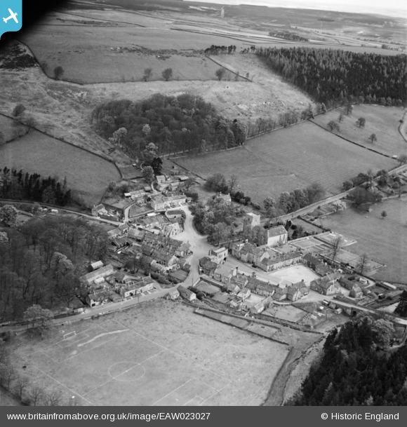
EAW023027 ENGLAND (1949). The village, Blanchland, from the south, 1949
© Copyright OpenStreetMap contributors and licensed by the OpenStreetMap Foundation. 2026. Cartography is licensed as CC BY-SA.
Nearby Images (9)
EAW023027

EAW017422

EAW017427

EAW017423

EAW017424

EAW017426

EAW023025

EAW023026

EAW017425

Details
| Title | [EAW023027] The village, Blanchland, from the south, 1949 |
| Reference | EAW023027 |
| Date | 9-May-1949 |
| Link | |
| Place name | BLANCHLAND |
| Parish | BLANCHLAND |
| District | |
| Country | ENGLAND |
| Easting / Northing | 396550, 550341 |
| Longitude / Latitude | -2.0537347375012, 54.847773136928 |
| National Grid Reference | NY966503 |
Pins

MB |
Sunday 29th of December 2013 10:23:10 AM |