
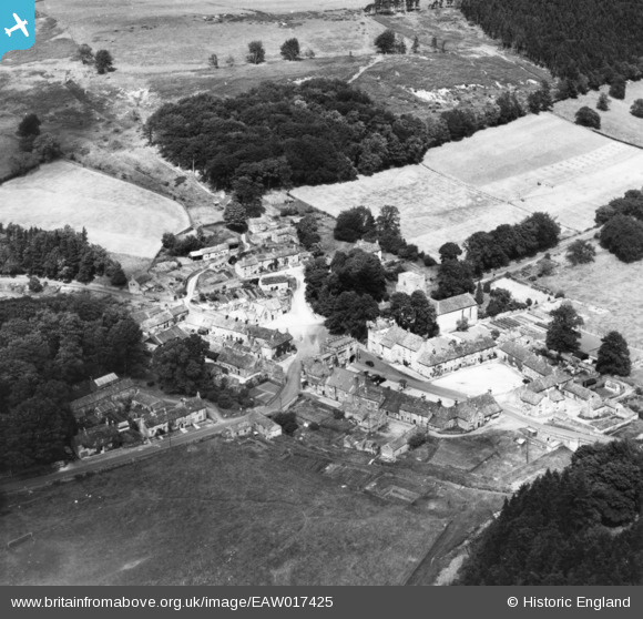
EAW017425 ENGLAND (1948). The village, Blanchland, 1948. This image has been produced from a print.
© Copyright OpenStreetMap contributors and licensed by the OpenStreetMap Foundation. 2026. Cartography is licensed as CC BY-SA.
Nearby Images (9)
EAW017425

EAW017423

EAW017426

EAW023026

EAW017424

EAW017427

EAW023025

EAW017422

EAW023027

Details
| Title | [EAW017425] The village, Blanchland, 1948. This image has been produced from a print. |
| Reference | EAW017425 |
| Date | 24-July-1948 |
| Link | |
| Place name | BLANCHLAND |
| Parish | BLANCHLAND |
| District | |
| Country | ENGLAND |
| Easting / Northing | 396585, 550435 |
| Longitude / Latitude | -2.0531907140515, 54.848618196312 |
| National Grid Reference | NY966504 |
Pins
Be the first to add a comment to this image!