
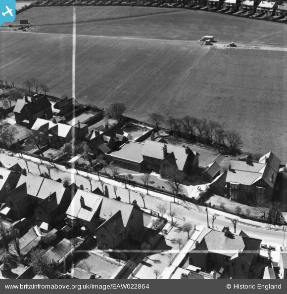
EAW022864 ENGLAND (1949). Monkseaton Grammar School on Holywell Avenue, Monkseaton, 1949. This image has been produced from a print marked by Aerofilms Ltd for photo editing.
© Copyright OpenStreetMap contributors and licensed by the OpenStreetMap Foundation. 2026. Cartography is licensed as CC BY-SA.
Nearby Images (3)
EAW022864

EAW022866

EAW022865

Details
| Title | [EAW022864] Monkseaton Grammar School on Holywell Avenue, Monkseaton, 1949. This image has been produced from a print marked by Aerofilms Ltd for photo editing. |
| Reference | EAW022864 |
| Date | 29-April-1949 |
| Link | |
| Place name | MONKSEATON |
| Parish | |
| District | |
| Country | ENGLAND |
| Easting / Northing | 434675, 572587 |
| Longitude / Latitude | -1.4572534406805, 55.046506665871 |
| National Grid Reference | NZ347726 |
Pins

Blyth Station Lad |
Sunday 22nd of September 2024 11:53:57 AM | |
|
Blyth Station Lad |
Sunday 22nd of September 2024 11:52:01 AM |