
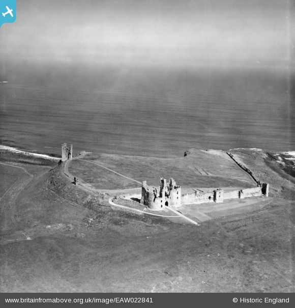
EAW022841 ENGLAND (1949). Dunstanburgh Castle, Craster, from the south, 1949
© Copyright OpenStreetMap contributors and licensed by the OpenStreetMap Foundation. 2026. Cartography is licensed as CC BY-SA.
Nearby Images (10)
EAW022841

EAW022840

EAW006080

EAW022839

EAW006079

EAW006081

EAW022843

EAW006077

EAW022842

EAW006078

Details
| Title | [EAW022841] Dunstanburgh Castle, Craster, from the south, 1949 |
| Reference | EAW022841 |
| Date | 30-May-1949 |
| Link | |
| Place name | CRASTER |
| Parish | CRASTER |
| District | |
| Country | ENGLAND |
| Easting / Northing | 425672, 621792 |
| Longitude / Latitude | -1.5936786924444, 55.489238918847 |
| National Grid Reference | NU257218 |
Pins

redmist |
Saturday 29th of April 2023 09:21:57 PM | |
 |
totoro |
Friday 17th of July 2015 09:57:35 PM |
|
totoro |
Friday 17th of July 2015 09:54:06 PM | |
|
totoro |
Friday 17th of July 2015 09:40:10 PM | |
|
totoro |
Friday 17th of July 2015 09:39:03 PM | |
|
totoro |
Friday 17th of July 2015 09:36:58 PM | |
|
totoro |
Friday 17th of July 2015 09:36:41 PM | |
|
totoro |
Friday 17th of July 2015 09:36:02 PM | |
|
totoro |
Friday 17th of July 2015 09:34:53 PM | |
|
totoro |
Friday 17th of July 2015 09:33:42 PM |