
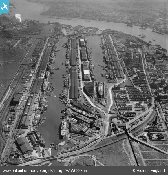
EAW022355 ENGLAND (1949). The Royal Albert and King George V Docks, North Woolwich, 1949
© Copyright OpenStreetMap contributors and licensed by the OpenStreetMap Foundation. 2026. Cartography is licensed as CC BY-SA.
Nearby Images (11)
EAW022355

EAW008746

EAW008742

EAW008741

EAW008745

EAW008747

EAW008744

EAW008743

EAW022356

EPW032926

EAW022353

Details
| Title | [EAW022355] The Royal Albert and King George V Docks, North Woolwich, 1949 |
| Reference | EAW022355 |
| Date | 19-April-1949 |
| Link | |
| Place name | NORTH WOOLWICH |
| Parish | |
| District | |
| Country | ENGLAND |
| Easting / Northing | 542367, 180464 |
| Longitude / Latitude | 0.051526042662778, 51.50466958904 |
| National Grid Reference | TQ424805 |
Pins

redmist |
Tuesday 30th of June 2020 09:48:38 AM | |
|
redmist |
Tuesday 30th of June 2020 09:48:09 AM | |
|
redmist |
Tuesday 30th of June 2020 09:46:55 AM |