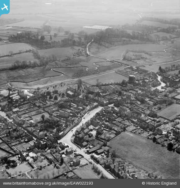
EAW022193 ENGLAND (1949). The village, Titchfield, 1949
© Copyright OpenStreetMap contributors and licensed by the OpenStreetMap Foundation. 2026. Cartography is licensed as CC BY-SA.
Nearby Images (5)
EAW022193

EAW022192

EAW022195

EAW022194

EAW022196

Details
| Title | [EAW022193] The village, Titchfield, 1949 |
| Reference | EAW022193 |
| Date | 17-April-1949 |
| Link | |
| Place name | TITCHFIELD |
| Parish | |
| District | |
| Country | ENGLAND |
| Easting / Northing | 454077, 105751 |
| Longitude / Latitude | -1.2317643039456, 50.848189788031 |
| National Grid Reference | SU541058 |
Pins

alastair wallace |
Monday 21st of March 2016 01:49:32 PM | |

Class31 |
Wednesday 5th of August 2015 08:50:07 AM | |
|
Class31 |
Wednesday 5th of August 2015 08:47:30 AM | |
|
Class31 |
Wednesday 5th of August 2015 08:44:52 AM | |
|
Class31 |
Wednesday 5th of August 2015 08:41:01 AM | |
|
Class31 |
Wednesday 5th of August 2015 08:39:54 AM | |
|
Class31 |
Wednesday 5th of August 2015 08:39:00 AM |