
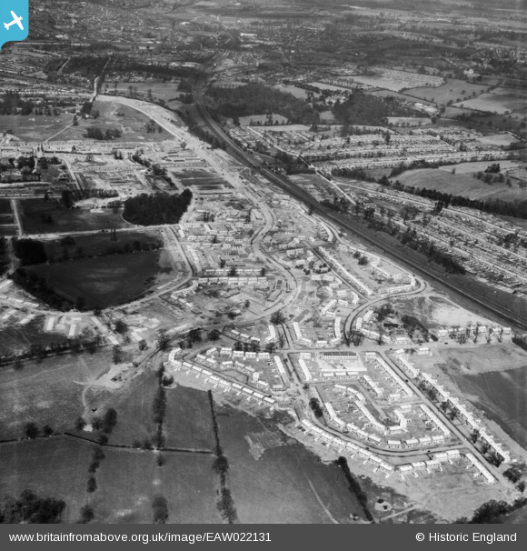
EAW022131 ENGLAND (1949). The South Oxhey Housing Estate under construction around Prestwick Road, South Oxhey, 1949
© Copyright OpenStreetMap contributors and licensed by the OpenStreetMap Foundation. 2026. Cartography is licensed as CC BY-SA.
Nearby Images (3)
EAW022131

EAW022133

EAW022129

Details
| Title | [EAW022131] The South Oxhey Housing Estate under construction around Prestwick Road, South Oxhey, 1949 |
| Reference | EAW022131 |
| Date | 14-April-1949 |
| Link | |
| Place name | SOUTH OXHEY |
| Parish | WATFORD RURAL |
| District | |
| Country | ENGLAND |
| Easting / Northing | 511792, 192761 |
| Longitude / Latitude | -0.3849378792056, 51.622082563332 |
| National Grid Reference | TQ118928 |
Pins

robert willis |
Saturday 25th of January 2020 02:39:15 PM | |
|
robert willis |
Saturday 25th of January 2020 02:38:31 PM | |
|
robert willis |
Saturday 25th of January 2020 02:38:08 PM |