
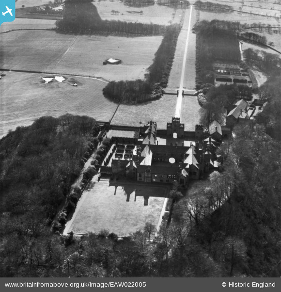
EAW022005 ENGLAND (1949). Hoghton Tower, Hoghton, 1949. This image has been produced from a print.
© Copyright OpenStreetMap contributors and licensed by the OpenStreetMap Foundation. 2026. Cartography is licensed as CC BY-SA.
Nearby Images (7)
EAW022005

EAW022006

EPW059509

EPW059507

EAW022008

EAW022007

EPW059508

Details
| Title | [EAW022005] Hoghton Tower, Hoghton, 1949. This image has been produced from a print. |
| Reference | EAW022005 |
| Date | 14-April-1949 |
| Link | |
| Place name | HOGHTON |
| Parish | HOGHTON |
| District | |
| Country | ENGLAND |
| Easting / Northing | 362247, 426400 |
| Longitude / Latitude | -2.5723401363797, 53.732402547141 |
| National Grid Reference | SD622264 |
Pins
Be the first to add a comment to this image!