
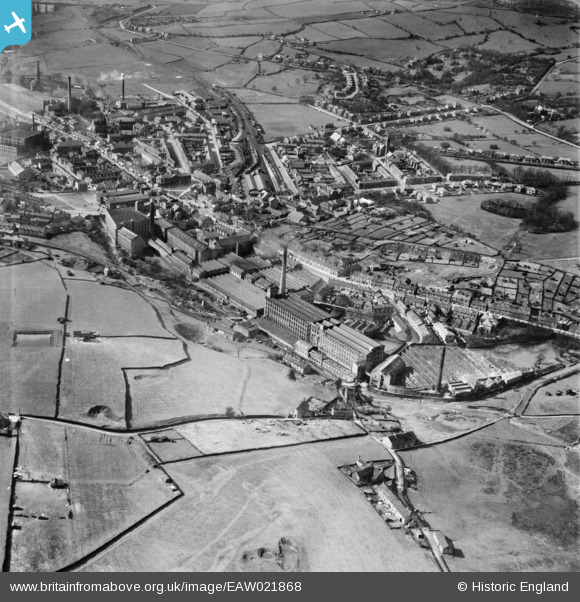
EAW021868 ENGLAND (1949). The Howard Town Cotton Mills and the town centre, Glossop, 1949
© Copyright OpenStreetMap contributors and licensed by the OpenStreetMap Foundation. 2026. Cartography is licensed as CC BY-SA.
Nearby Images (6)
EAW021868

EAW021870

EAW021867

EAW021871

EAW021869

EAW021865

Details
| Title | [EAW021868] The Howard Town Cotton Mills and the town centre, Glossop, 1949 |
| Reference | EAW021868 |
| Date | 8-April-1949 |
| Link | |
| Place name | GLOSSOP |
| Parish | |
| District | |
| Country | ENGLAND |
| Easting / Northing | 403732, 394012 |
| Longitude / Latitude | -1.9438084238587, 53.442609587701 |
| National Grid Reference | SK037940 |
Pins

Arthur |
Friday 18th of March 2016 06:19:44 PM | |
|
Arthur |
Friday 18th of March 2016 06:18:42 PM | |
|
Arthur |
Friday 18th of March 2016 06:12:59 PM | |
|
Arthur |
Friday 18th of March 2016 06:12:23 PM | |
|
Arthur |
Friday 18th of March 2016 06:11:54 PM | |
|
Arthur |
Friday 18th of March 2016 06:08:19 PM | |
|
Arthur |
Friday 18th of March 2016 06:07:40 PM |