
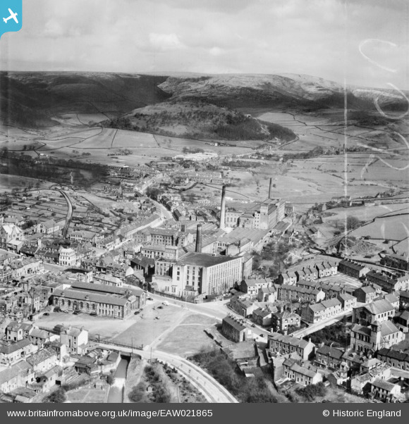
EAW021865 ENGLAND (1949). The Howard Town Cotton Mills, Glossop, from the south-west, 1949. This image was marked by Aerofilms Ltd for photo editing.
© Copyright OpenStreetMap contributors and licensed by the OpenStreetMap Foundation. 2026. Cartography is licensed as CC BY-SA.
Nearby Images (4)
EAW021865

EAW021866

EAW021870

EAW021868

Details
| Title | [EAW021865] The Howard Town Cotton Mills, Glossop, from the south-west, 1949. This image was marked by Aerofilms Ltd for photo editing. |
| Reference | EAW021865 |
| Date | 8-April-1949 |
| Link | |
| Place name | GLOSSOP |
| Parish | |
| District | |
| Country | ENGLAND |
| Easting / Northing | 403487, 393951 |
| Longitude / Latitude | -1.9474979877769, 53.442062903554 |
| National Grid Reference | SK035940 |
Pins
Be the first to add a comment to this image!