
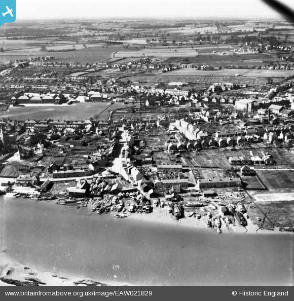
EAW021829 ENGLAND (1949). North Street and environs, Maldon, from the north-east, 1949. This image has been produced from a print.
© Copyright OpenStreetMap contributors and licensed by the OpenStreetMap Foundation. 2026. Cartography is licensed as CC BY-SA.
Nearby Images (7)
EAW021829

EAW001532

EAW043493

EAW021830

EPW054680

EPW054678

EAW001530

Details
| Title | [EAW021829] North Street and environs, Maldon, from the north-east, 1949. This image has been produced from a print. |
| Reference | EAW021829 |
| Date | 9-April-1949 |
| Link | |
| Place name | MALDON |
| Parish | MALDON |
| District | |
| Country | ENGLAND |
| Easting / Northing | 585692, 206941 |
| Longitude / Latitude | 0.68922467085046, 51.729925449565 |
| National Grid Reference | TL857069 |
Pins

TuckPrior |
Tuesday 2nd of September 2014 09:43:21 PM |