
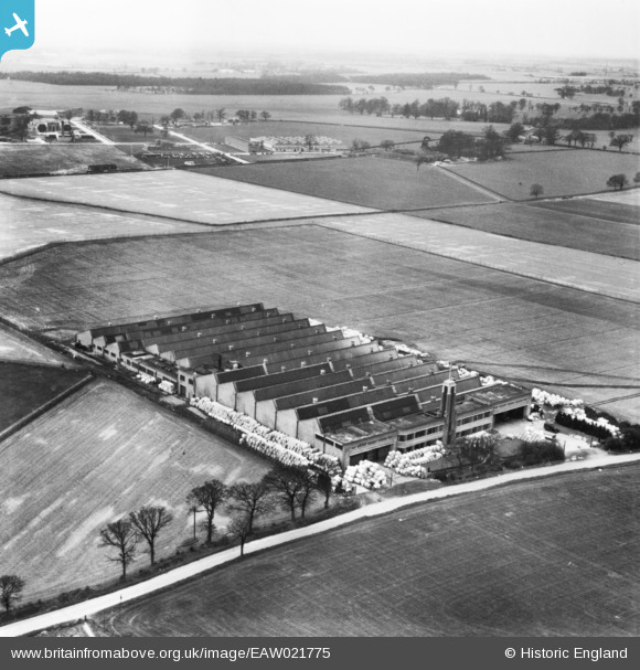
EAW021775 ENGLAND (1949). Cook's Cardboard Box Factory off Great Braitch Lane, Hatfield, from the north-east, 1949. This image has been produced from a print.
© Copyright OpenStreetMap contributors and licensed by the OpenStreetMap Foundation. 2026. Cartography is licensed as CC BY-SA.
Nearby Images (12)
EAW021775

EAW024929

EAW024932

EAW024934

EAW021778

EAW021776

EAW021777

EAW024928

EAW024931

EAW024927

EAW024930

EAW024933

Details
| Title | [EAW021775] Cook's Cardboard Box Factory off Great Braitch Lane, Hatfield, from the north-east, 1949. This image has been produced from a print. |
| Reference | EAW021775 |
| Date | 5-April-1949 |
| Link | |
| Place name | HATFIELD |
| Parish | HATFIELD |
| District | |
| Country | ENGLAND |
| Easting / Northing | 521833, 210185 |
| Longitude / Latitude | -0.23385810737363, 51.776603986753 |
| National Grid Reference | TL218102 |
Pins

Matt Aldred edob.mattaldred.com |
Monday 11th of March 2024 03:06:31 PM |