
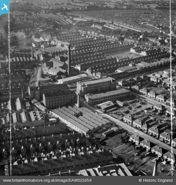
EAW021659 ENGLAND (1949). The Chilprufe Ltd Hosiery and Knitwear Mills and surrounding streets, Leicester, 1949. This image was marked by Aerofilms Ltd for photo editing.
© Copyright OpenStreetMap contributors and licensed by the OpenStreetMap Foundation. 2026. Cartography is licensed as CC BY-SA.
Nearby Images (24)
EAW021659

EAW021658

EPW035978

EPW035984

EPW035986

EPW057120

EPW035979

EPW057116

EPW057119

EPW035985

EPW035983

EPW057118

EAW021657

EPW035988

EPW035987

EPW035981

EAW021653

EPW035982

EPW057117

EPW035980

EPW057121

EAW021654

EAW021656

EAW021655

Details
| Title | [EAW021659] The Chilprufe Ltd Hosiery and Knitwear Mills and surrounding streets, Leicester, 1949. This image was marked by Aerofilms Ltd for photo editing. |
| Reference | EAW021659 |
| Date | 24-March-1949 |
| Link | |
| Place name | LEICESTER |
| Parish | |
| District | |
| Country | ENGLAND |
| Easting / Northing | 461093, 304989 |
| Longitude / Latitude | -1.0970823395797, 52.638852259389 |
| National Grid Reference | SK611050 |
Pins

Matt Aldred edob.mattaldred.com |
Thursday 7th of March 2024 04:41:23 PM | |
|
Matt Aldred edob.mattaldred.com |
Thursday 7th of March 2024 04:39:35 PM | |

rroger156 |
Saturday 28th of December 2013 07:06:03 PM |