
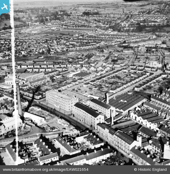
EAW021654 ENGLAND (1949). The Chilprufe Ltd Hosiery and Knitwear Mills and surrounding streets, Leicester, 1949. This image has been produced from a print marked by Aerofilms Ltd for photo editing.
© Copyright OpenStreetMap contributors and licensed by the OpenStreetMap Foundation. 2026. Cartography is licensed as CC BY-SA.
Nearby Images (29)
EAW021654

EAW021653

EPW057118

EAW021656

EPW057121

EAW021657

EAW021658

EAW021659

EPW057120

EPW035978

EPW035986

EPW057116

EPW057119

EPW035984

EPW035979

EPW057117

EAW021655

EPW035983

EPW035985

EPW035980

EPW035987

EPW035988

EPW035982

EPW035981

EAW024260

EAW024259

EAW024265

EAW024258

EAW024264

Details
| Title | [EAW021654] The Chilprufe Ltd Hosiery and Knitwear Mills and surrounding streets, Leicester, 1949. This image has been produced from a print marked by Aerofilms Ltd for photo editing. |
| Reference | EAW021654 |
| Date | 24-March-1949 |
| Link | |
| Place name | LEICESTER |
| Parish | |
| District | |
| Country | ENGLAND |
| Easting / Northing | 461187, 305023 |
| Longitude / Latitude | -1.0956869610135, 52.639147313842 |
| National Grid Reference | SK612050 |
Pins

Matt Aldred edob.mattaldred.com |
Thursday 7th of March 2024 04:41:35 PM | |
|
Matt Aldred edob.mattaldred.com |
Thursday 7th of March 2024 04:40:29 PM | |
|
Matt Aldred edob.mattaldred.com |
Monday 27th of February 2023 02:47:22 PM |