
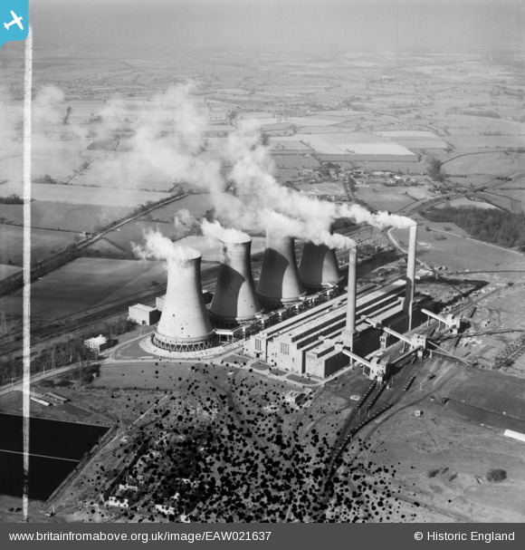
EAW021637 ENGLAND (1949). Hams Hall Power Station B, Lea Marston, from the south, 1949. This image has been produced from a damaged negative.
© Copyright OpenStreetMap contributors and licensed by the OpenStreetMap Foundation. 2026. Cartography is licensed as CC BY-SA.
Nearby Images (5)
EAW021637

EAW021635

EPW023693

EAW021636

EAW021638

Details
| Title | [EAW021637] Hams Hall Power Station B, Lea Marston, from the south, 1949. This image has been produced from a damaged negative. |
| Reference | EAW021637 |
| Date | 25-March-1949 |
| Link | |
| Place name | LEA MARSTON |
| Parish | LEA MARSTON |
| District | |
| Country | ENGLAND |
| Easting / Northing | 419941, 292314 |
| Longitude / Latitude | -1.7060296918788, 52.527968338454 |
| National Grid Reference | SP199923 |
Pins
Be the first to add a comment to this image!
User Comment Contributions
Now the site of Hams Hall Distribution Park and Hams Hall Rail Freight Terminal. This is probably Hams Hall B or C power station, built post war with modern concrete cooling towers. All the power stations here ceased operating in 1993 and the site was subsequently cleared prior to redevelopmet |

MB |
Sunday 5th of January 2014 12:01:54 PM |