
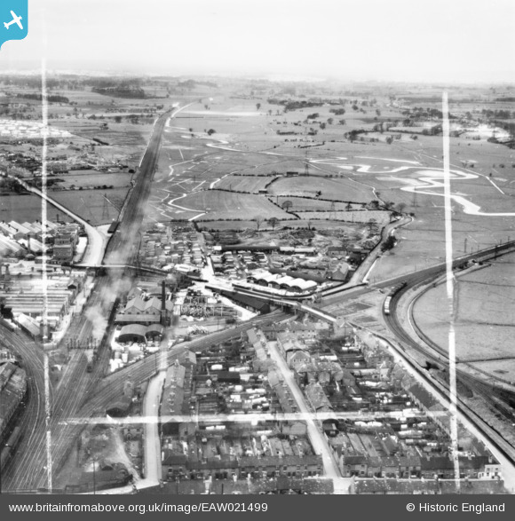
EAW021499 ENGLAND (1949). Henry Venables Ltd Castletown Saw Mill and environs, Stafford, from the south-east, 1949. This image has been produced from a print marked by Aerofilms Ltd for photo editing.
© Copyright OpenStreetMap contributors and licensed by the OpenStreetMap Foundation. 2026. Cartography is licensed as CC BY-SA.
Nearby Images (35)
EAW021499

EAW021494

EAW015401

EAW021495

EAW015404

EAW001871

EAW021603

EAW021600

EAW021602

EAW015406

EAW000385

EAW021601

EAW021608

EAW021604

EAW001873

EAW001868

EAW021605

EAW001869

EAW001874

EAW015403

EPW046130

EAW021498

EAW000898

EAW015405

EAW015407

EAW021497

EPW046129

EPW014112

EPW046125

EAW000392

EAW021496

EAW021606

EAW001872

EAW015402

EAW001870

Details
| Title | [EAW021499] Henry Venables Ltd Castletown Saw Mill and environs, Stafford, from the south-east, 1949. This image has been produced from a print marked by Aerofilms Ltd for photo editing. |
| Reference | EAW021499 |
| Date | 15-March-1949 |
| Link | |
| Place name | STAFFORD |
| Parish | |
| District | |
| Country | ENGLAND |
| Easting / Northing | 391575, 323329 |
| Longitude / Latitude | -2.1249952382366, 52.807114796265 |
| National Grid Reference | SJ916233 |
Pins

iain1940 |
Saturday 19th of October 2019 06:39:34 PM |