
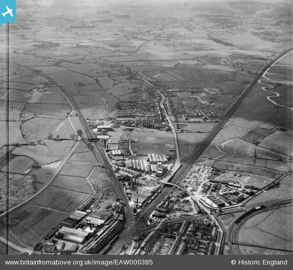
EAW000385 ENGLAND (1946). The Universal Grinding Wheel Works and the village, Doxey, from the east, 1946. This image has been produced from a damaged negative.
© Copyright OpenStreetMap contributors and licensed by the OpenStreetMap Foundation. 2026. Cartography is licensed as CC BY-SA.
Nearby Images (48)
EAW000385

EPW046130

EAW000898

EAW021602

EAW000392

EAW021605

EPW046129

EPW046125

EAW001874

EAW021600

EPW046124

EAW000904

EAW021601

EAW000901

EAW021604

EAW001873

EAW021608

EAW001868

EAW000900

EAW001869

EAW001871

EAW000388

EAW021603

EAW021496

EAW000391

EAW021498

EAW000899

EPW046128

EAW000387

EAW000903

EAW000386

EAW015406

EPW046127

EPW046126

EPW057691

EAW001872

EAW000389

EAW015407

EAW021497

EPW057687

EPW057688

EPW057689

EAW000390

EAW015405

EAW021607

EPW057690

EAW001870

EAW015402

Details
| Title | [EAW000385] The Universal Grinding Wheel Works and the village, Doxey, from the east, 1946. This image has been produced from a damaged negative. |
| Reference | EAW000385 |
| Date | 17-April-1946 |
| Link | |
| Place name | DOXEY |
| Parish | DOXEY |
| District | |
| Country | ENGLAND |
| Easting / Northing | 391396, 323337 |
| Longitude / Latitude | -2.127651126954, 52.807183893724 |
| National Grid Reference | SJ914233 |
Pins
Be the first to add a comment to this image!
User Comment Contributions

Doxey Road, Stafford, 13/08/2015 |

Class31 |
Saturday 29th of August 2015 10:06:21 PM |