
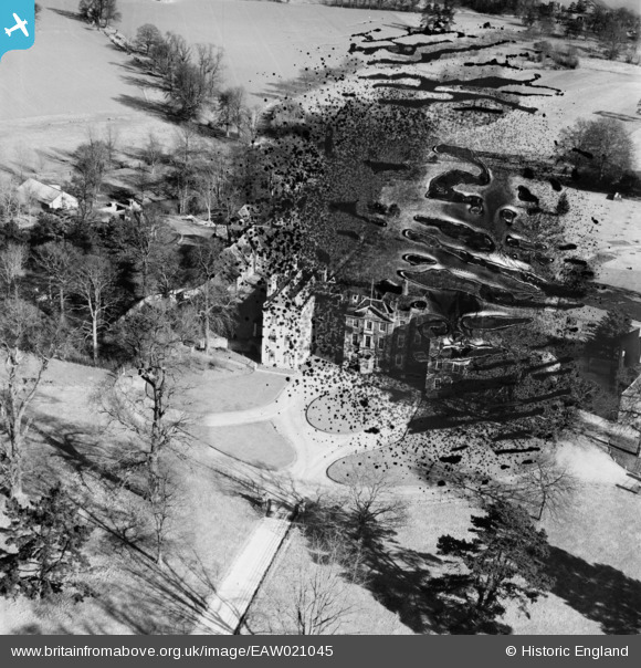
EAW021045 ENGLAND (1949). Langleys, Great Waltham, 1949. This image has been produced from a damaged negative.
© Copyright OpenStreetMap contributors and licensed by the OpenStreetMap Foundation. 2026. Cartography is licensed as CC BY-SA.
Nearby Images (4)
EAW021045

EAW021046

EAW021041

EAW021042

Details
| Title | [EAW021045] Langleys, Great Waltham, 1949. This image has been produced from a damaged negative. |
| Reference | EAW021045 |
| Date | 16-February-1949 |
| Link | |
| Place name | GREAT WALTHAM |
| Parish | GREAT WALTHAM |
| District | |
| Country | ENGLAND |
| Easting / Northing | 569920, 213676 |
| Longitude / Latitude | 0.46434375959009, 51.79543416571 |
| National Grid Reference | TL699137 |
Pins

Matt Aldred edob.mattaldred.com |
Saturday 29th of January 2022 10:09:00 PM |